Island in the Sky is one of the three sections of Canyonlands National Park. The Island in the Sky is a mesa which sits on sandstone cliffs over 1000 feet above the surrounding terrain. It is the most easily accessible section from Moab and contains a 34 mile roundtrip scenic drive including Mesa Arch and Grand View Point, which are accessible by short hikes.
Island in the Sky Visitor Center
The visitor center is open five days a week in winter and seven days a week the rest of the year. It is located about 40 minutes from Moab via US 191 and UT 313. There is a viewpoint across the street from the visitor center.
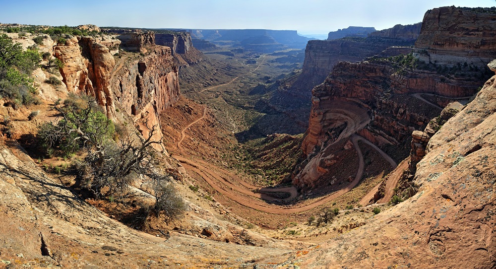
Shafer Trail Road
Shafer Canyon is composed of scenic sandstone cliffs located in Canyonlands National Park. There is an overlook of the canyon and the trail along Grand View Point Rd. Shafer Trail Road allows visitors to travel between the mesa and floor via a series of hair raising switchbacks accessible to high clearance all wheel drive vehicles. The trail is not for those who are afraid of heights.
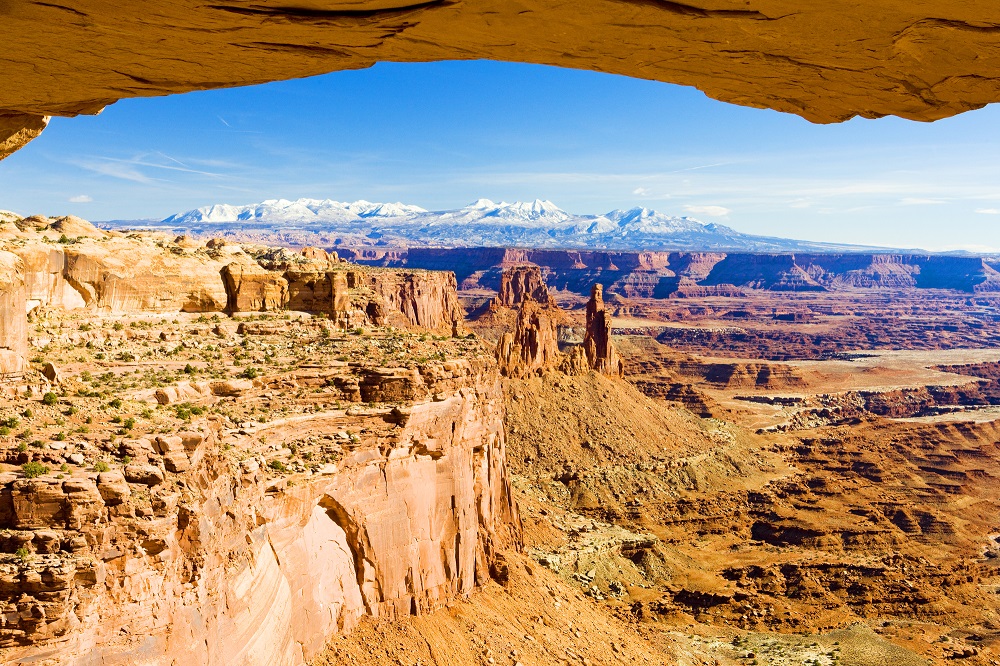
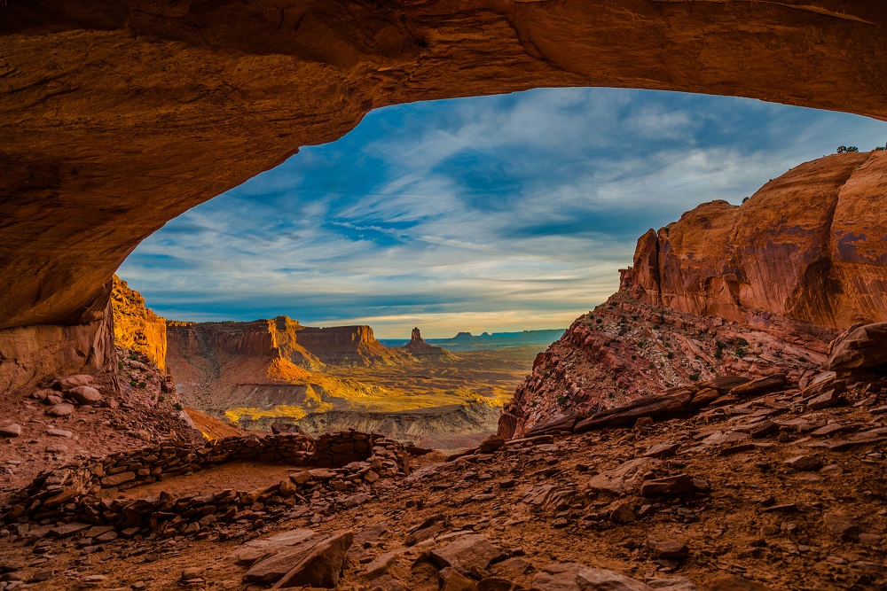
Mesa Arch
Mesa Arch is located on the eastern edge of the Island in the Sky in Canyonlands National Park. It is a popular stone arch perched at the end of a cliff with views of canyons, rock spires and the La Sal Mountains. Do not miss this iconic structure of Canyonlands reached by an easy half mile hike. Mesa Arch is classified as a pothole arch because surface water that pooled on the sandstone eroded the rock.
Island in the Sky Campground
The Willow Flat campground in Island of the Sky has 12 campsites available year-round via first-come, first serve (no reservations). It is located near the Green River overlook. The sites are $15 and fill quickly from the spring through the fall. There is no water at the campground.
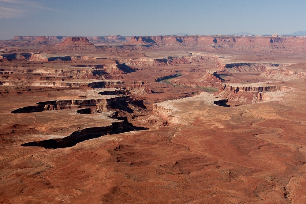
Green River Overlook
To reach the Green River overlook, turn on Upheaval Dome Rd near Mesa Arch and then turn again onto Green River Overlook Rd. Pass the Willow Flat Campgrounds and it is at the end of the road.
False Kiva
The False Kiva is a human-made stone circle of unknown origin in a remote section of the park that was closed in 2018 due to vandalism. The archaeological site is cordoned off by junipers according to reports. It was reached via a maintained trail that is not marked or located on park maps (follow the cairns).
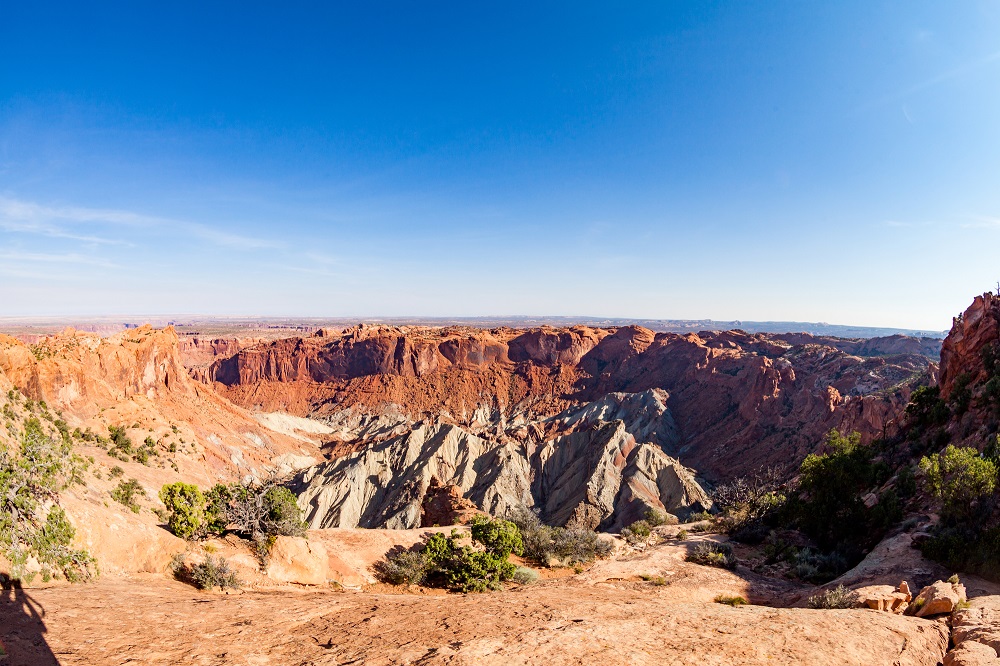
Upheaval Dome
Upheaval Dome is a 5 kilometer impact crater in Island of the Sky. The area contains deformed rock layers in contrast to the systematic record of sedimentary deposits in other areas of the park. Recent research supports the theory that a meteorite with a diameter of 1/3 mile hit the area 60 million years ago. Other geologists believe that it is the most deeply eroded salt structure on earth. The turn for Upheaval Dome Road is just past Mesa Arch.
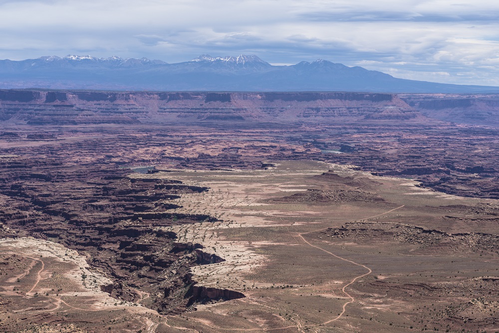
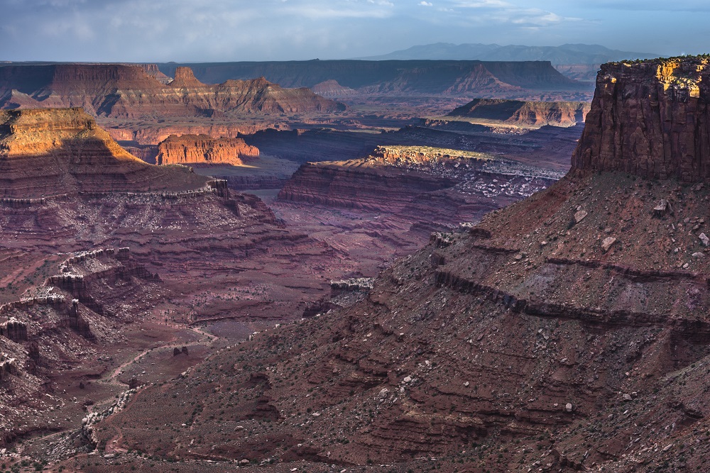
Grand View Point
Grand View Point is located at an elevation of 6000+ feet at the southern-most spot on the high mesa of Island in the Sky. The overlook is reached by an easy two mile round-trip hike which is one of the most popular in the park. The end of the trail is a good place to watch the sunset.
Buck Canyon Overlook
Buck Canyon Overlook faces east from along Grand View Point Road and provides a scenic overlook which includes the canyon of the Colorado River. To avoid making a left turn into the parking lot, stop here on the return from Grand View Point Overlook.
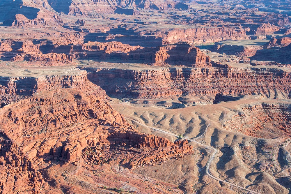
White Rim Road
White Rim Road is an unpaved 71.2 mile road for four wheel drive vehicles on the White Rim Sandstone formation below the Island in the Sky mesa. It can be reached by vehicles from Horsethief Trail in the west of Island in the Sky, Shafer Trail in the east, or Potash Road coming from Moab. There are also seven steep trails allowing hikers to reach the road from the Island in the Sky. There is very limited access to the Green River and the Colorado River along the White Rim. Permits have been required for day use and overnight trips by motor vehicle or bicycle on the road since September 2015.
Marlboro Point
Marlboro Point overlooks the Green River and Canyonlands National Park. It is located near the entrance to Canyonlands National Park and Dead Horse Point State Park.
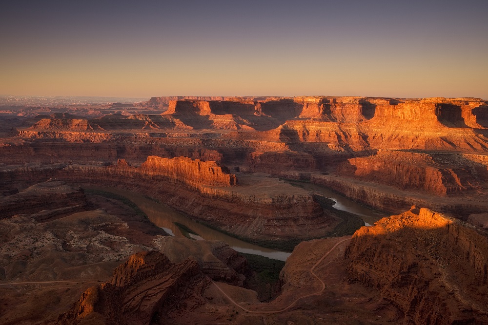
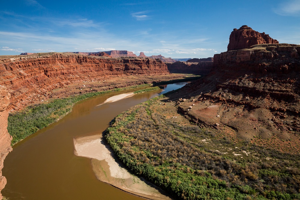
Dead Horse Point State Park
Dead Horse Point is a 5,362 acre Utah state park located near the entrance to Canyonlands National Park 32 miles from Moab. Dead Horse Point overlooks the Colorado River and Canyonlands National Park. The Visitor Center is open year round with closures on Thanksgiving Day, Christmas Day and New Years Day. The park is visited by more than a half million people a year.