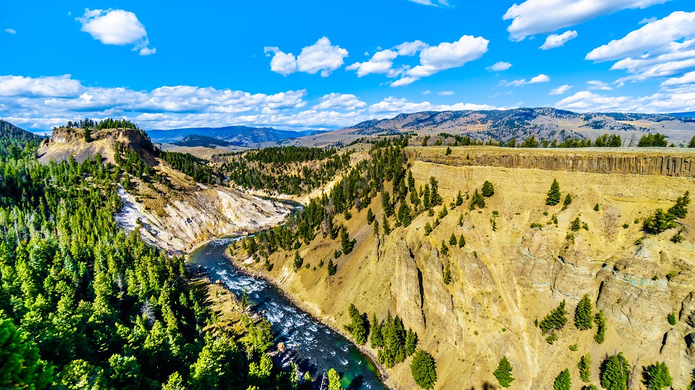
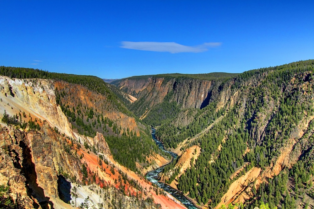
The Grand Canyon of the Yellowstone is an approximately 20 mile canyon in Yellowstone National Park, running from the Upper Falls of the Yellowstone River to the Tower Fall area. The canyon is centrally located in the northern section of the park. It is a highlight of the river, which is the last major undammed river in the lower 48 states. It is the longest undammed river in the continental United States.
The Grand Canyon of the Yellowstone has been formed by the erosion of the area’s rock and sediment by the Yellowstone River. The area upstream from the Upper Falls as well as the volcanic rock around the Lower Falls are more resistant to erosion than the rocks which are downstream. The canyon continues from the Upper Falls where it starts to the end at the Calcite Springs downstream of Tower Fall.
The Grand Canyon is easily accessible at its start and finish. The north rim and south rim of the canyon can be accessed by roads off the Grand Loop Road. Canyon Village is nearby, with a lodge, general store, campground, restaurants and more. The end of the canyon downstream is near the Tower Fall and Tower-Roosevelt area, which contains a campground, Roosevelt Lodge, and a service station.
The present canyon is estimated to be around 10,000 to 14,000 years old. It is a V-shaped valley which is typically created by a river rather than glaciers. At the end of the last glacial period, ice dams formed at Yellowstone Lake which released flash floods downstream when they melted. Over time, the rocks have continued to erode. There was probably a canyon here in some form before the last glacial period.
Upper Falls
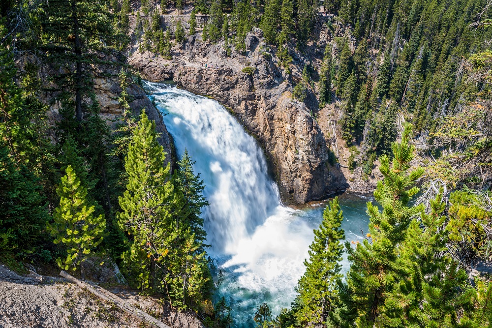
The Upper Falls of the Yellowstone River is a 109 foot waterfall that formed at the transition between a hard lava flow and a weaker lava flow that has eroded over time.
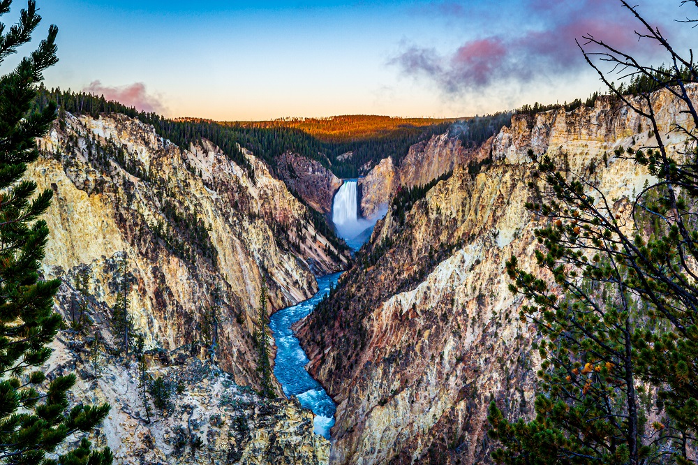
Lower Falls
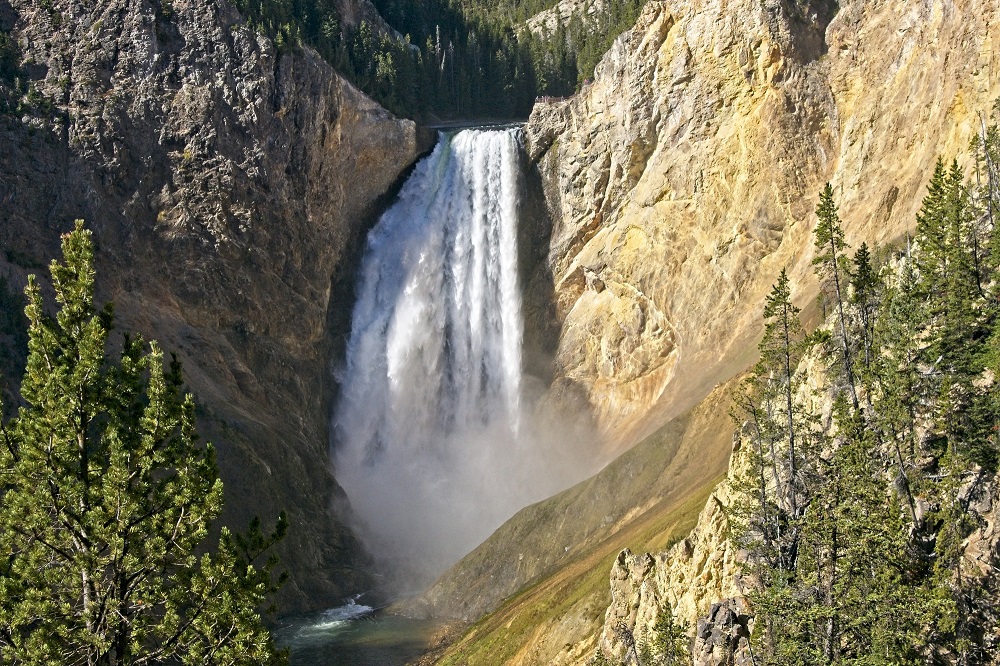
The Lower Falls is a waterfall with a drop of 308 feet, making it the tallest waterfall in the park. It is no match for the jaw dropping height of Yosemite waterfalls, but it is nearly twice the height of Niagara Falls. At one time, there was a geyser basin below the Lower Falls, which altered the rock and made it more susceptible to erosion.
North Rim
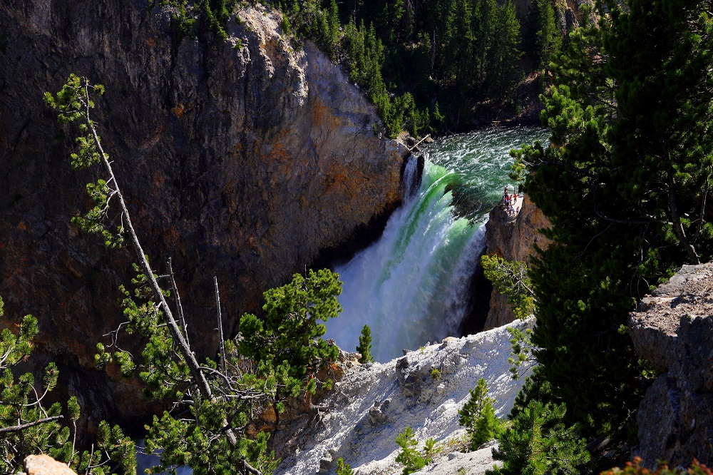
The one way North Rim Drive begins 1.2 miles south of Canyon Junction and provides access to various observation points of the Lower Falls and the canyon including Lookout Point, Grand View and Inspiration Point.
Brink of Lower Falls
Inspiration Point
South Rim
The South Rim Drive provides access to observation points for the Upper Falls and Lower Falls including Uncle Tom’s Point (view of Upper Falls) and Artist Point (view of Lower Falls). The South Rim Drive provides access to Uncle Tom’s Trail, which descends to a viewpoint near the base of the Lower Yellowstone Falls via stairs.
Artist Point – A classic view of the Lower Falls and the Grand Canyon. It is accessed by a short trail from the end of the South Rim Drive. Lower Falls is about a mile away from the observation point.
Canyon Village
Canyon Village is centrally located in Yellowstone National Park with a lodge, general store, campground, restaurants and more. It is located between a half mile and a mile from teh canyon. Canyon Lodge has hotel rooms for visitors inside the lodges as well as rustic cabins. The Canyon Campground has 273 campsites, with reservations accepted online. Dining options in the area include the Canyon Lodge Eatery, M66 Bar & Grill, Falls Cafe and the Ice Creamery.
North End of the Canyon
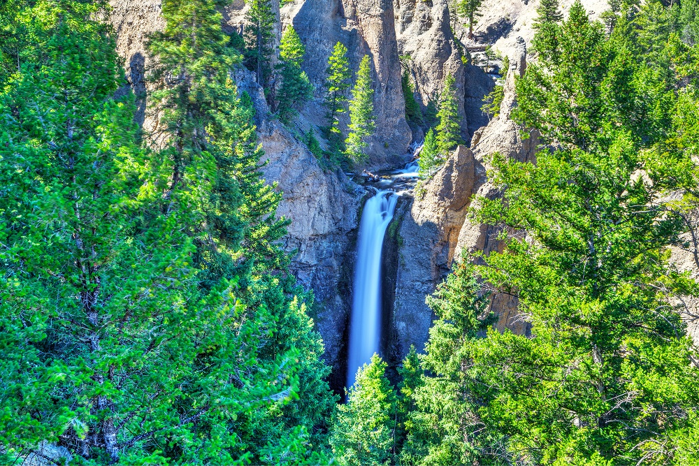
Tower Fall – This 132 foot waterfall of the Tower Creek is just upstream from the Yellowstone River. Tower Creek joins with the Yellowstone River about 3000 feet below the falls. It was the subject of a 1871 painting by Thomas Moran that aided in the establishment of Yellowstone National Park by Congress.
Calcite Springs – The Calcite Springs Overlook of the Yellowstone River serves as an observation point for the Calcite Springs.