We set out from Grand Junction to complete our drive to a conference in San Francisco, with the plan to visit two new national parks along the way – Capitol Reef National Park and Grand Basin National Park. Not far past the exit for Moab, we dropped down from I-70 towards Capitol Reef on Utah State Route 24 to enter the middle of Capitol Reef from the east.
Capitol Reef is one of five national parks in Utah, and one of the three remaining that we haven’t visited. With a couple trips to Arches and Canyonlands under our belt, we decided to take a little detour during our drive across the country to pick this one up and leave just Zion and Bryce Canyon remaining.
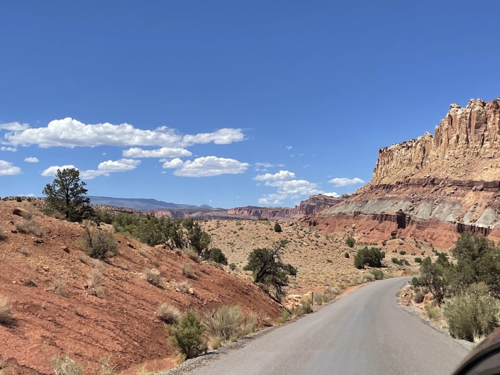
Capitol Reef protects a 100 mile long waterpocket fold, where the earth buckled and the eastern land sits dramatically higher than the western land. The geological feature makes east-west travel through this section of Utah difficult, since there are only a few roads that cross the waterpocket fold.
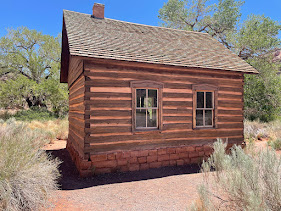
The national park also preserves the Fruita historic district which was settled by Mormons in the 1880s, contains the Guifford Farmhouse, a one room schoolhouse, and an heirloom fruit orchard.
As we drove into the park we descended through the Fremont River Canyon through the waterpocket fold, and made our first stop to explore at the petroglyphs and one room schoolhouse. The petroglyphs and pictographs are attributed to the Fremont culture between 300 and 1300 CE.
The schoolhouse was the only public building in Fruita. Built in 1896, it also served as a church meeting house, community center, and dance hall. The last class of students attended the school in 1941 before it closed.
Our next stop was the visitor center, and since we had a sleeping child and there was limited parking I ended up staying at the car while Jayne ran in. It actually worked out well as I was able to see a large bird like an eagle fly over the car and the visitor center while Jayne was inside. I never did identify that bird, but it was pretty cool to see glide over us.
Our next stop was the farmhouse area, where we ended up buying two pies.
We explored the scenic drive for a bit, stopping at _______________, and then turned around.
We continued on Route 24 and reunited with civilization shortly. Our drive would take us on Highway 50 for much of the way, as we crossed Utah to Great Basin. We had dinner in Delta, and then set off to the west for Baker, Nevada the gateway town to Great Basin National Park. We ended up staying at a motel on 50 on the Utah and Nevada border.
The next morning we headed into Baker, where we got some food and then continued into the park.
Great Basin is named for the largest contiguous drainage basin in North America with no outlet to the ocean. It includes nearly all of Nevada, a significant amount of Utah, and portions of California, Idaho, Oregon and Wyoming. The park protects and showcases some of the diversity of the region, ranging from the lower elevations to the summit of Wheeler Peak.
The scenic drive through the park starts at an elevation of around 6000 feet above sea level and at its highest point is at around 10,000 feet above sea level. We got so high that we actually encountered snow in June!
Unfortunately, I had to take a work call and there was no cell service at the top, so we worked our way back down to Mather Overlook where I did have cell coverage and hung out there for a few minutes to enjoy the view. We then continued our journey back down to the Lehman Caves Visitor Center.
One of the other popular attractions at Great Basin is Lehman Caves. Lehman Caves is the longest cave system in the state of Nevada and tours have been entering the case since 1885. Since I did not know our schedule I did not buy tickets for a cave tour in advance, and when we got there they were sold out for the tours in our time frame that would allow a toddler. We resolved to plan better on our next trip there!
After Great Basin we headed west on Nevada’s Highway 50, which we came to agree with Life magazine is the Loneliest Road in America. One of the things that we did discover on the journey and enjoy was checking out the Cold Springs Station of the Pony Express. The Pony Express ran from April 1860 to October 1861, allowing communications to be carried across 2000 miles in only 10 days. The Pony Express ended when the Transcontinental Telegraph Line was completed that month.