The boardwalk loop at Congaree National Park is an elevated 2.4 mile trail that offers a roundtrip hike through the largest remaining tract of old-growth bottomland hardwood forest in North America.
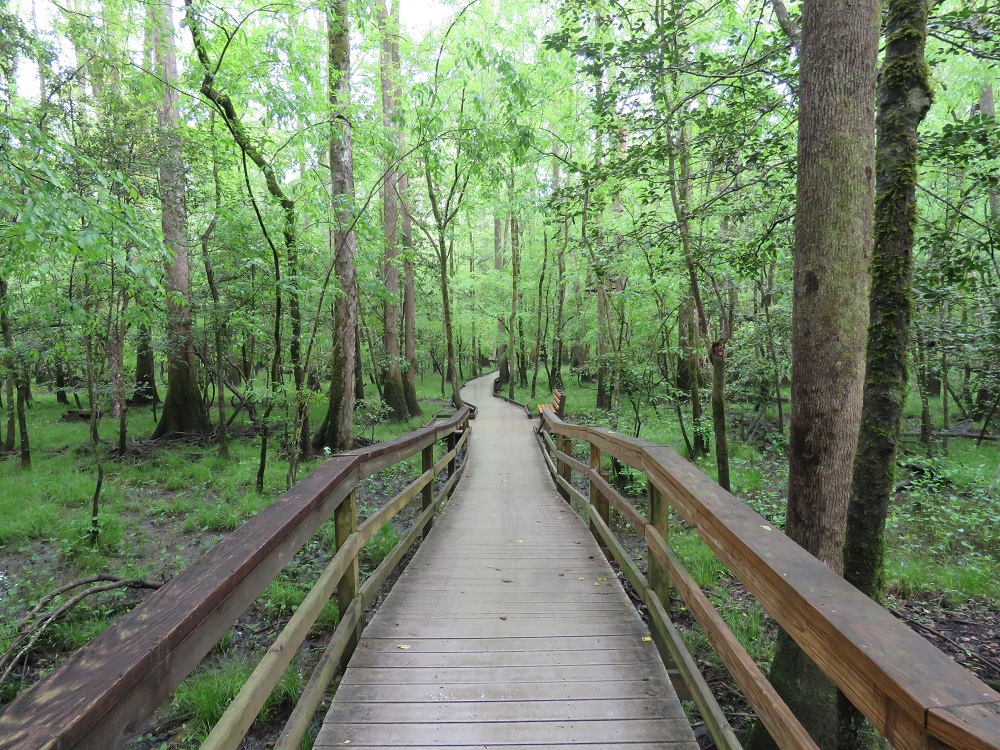
The Congaree National Park boardwalk starts behind the Harry Hampton Visitor Center. It runs south of the visitor center. The boardwalk intersects with a number of trails through the park including the Sims trail, the Bluff trail and the Weston Lake Loop Trail.
Be sure to stop in to the visitor center to check conditions because portions of the boardwalk may be underwater when there is flooding of the Congaree River and Cedar Creek. You can also pickup a guide to the twenty (20) marked locations along the boardwalk.
There are a number of other hiking areas in the area. However, when there is flooding, portions of the boardwalk and Bluff trail may be the only available hiking. Flooding can occur even if it is not raining in the national park because of rains upstream from Columbia. Congaree is a swamp, after all. For those trying to plan a trip, flooding happens more frequently in November through April. In the summer, the area can be extremely hot and the mosquitos can be ridiculous. To give you some idea, at the visitor center, there is a sign offering a perspective on the insect situation from “All Clear” to “War Zone”.
Before you depart for the boardwalk, be sure that you have water and insect repellant. There are also no restrooms along the boardwalk, so be sure to use the options outside at the visitor center.
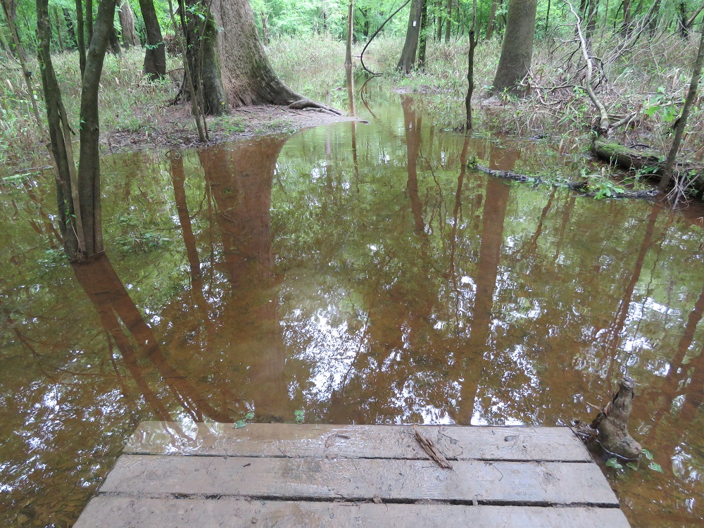
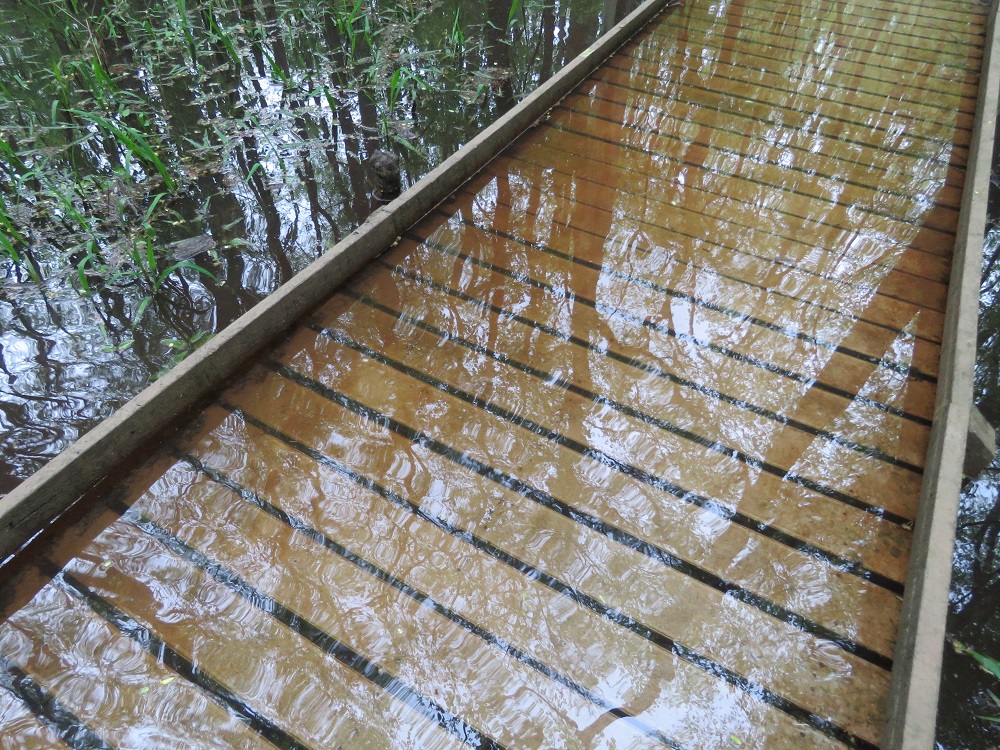
If there is flooding, the heightened boardwalk on the east is usually the best option. We were there for two days in April 2019 and the water was too high to travel around the boardwalk on the first day. We made it all the way down to Weston Lake, but this was the view when we turned west on the loop trail from there:
On the second day when the water was lower, the low boardwalk had a few small spots under water but we were able to make it all the way around. This was one of the areas of the low boardwalk that we were still able to walk through without a problem. However, it is worth noting that the park rangers do not recommend that you walk through flooded areas.
The south side of the boardwalk between the Weston Lake overlook observation point and Sims Trail was also reportedly flooded the day before we were there, according to the park rangers.
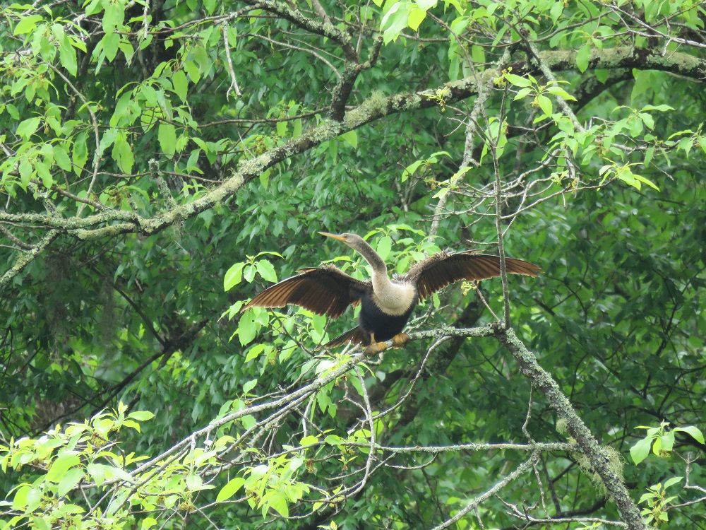
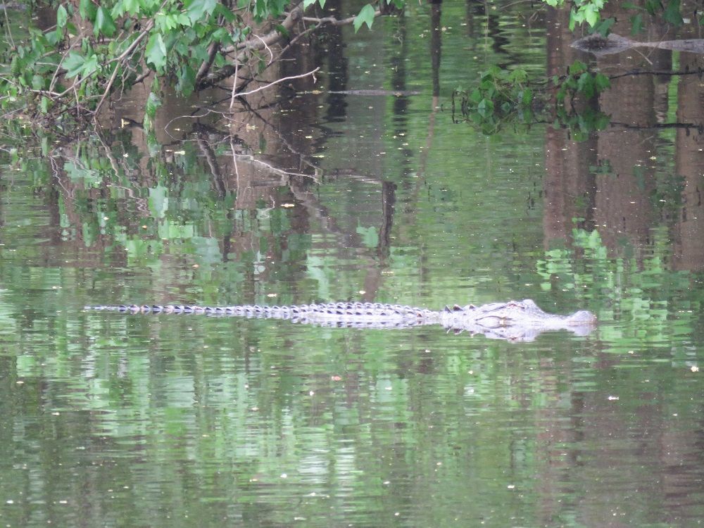
The highlights of the boardwalk for us were largely around Weston Lake. At the observation point, we saw two turtles on the first day as well as a diving bird drying its wings across the lake. On the second day, we saw an alligator making its way through the lake.

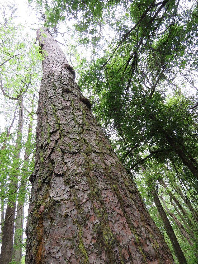
We also enjoyed seeing the Richland County Pine near there, which is a loblolly pine and one of the former champion trees in the national park. The tree just off the boardwalk is over 150 feet tall and dates back to the 1750s.