One of the best ways to see Congaree National Park is by canoe or kayak. There are two waterway trails through the park: the Congaree River Blue Trail and the Cedar Creek Canoe Trail. If you are visiting here to enjoy the meandering waterways through the old growth forest and champion trees, grab a paddle!
Reminder: Don’t forget to bring insect repellent for the mosquitos and watch out for snakes dangling overhead. There are 21 species of snakes in Congaree, though most of them are nonvenomous.
Congaree River Blue Trail
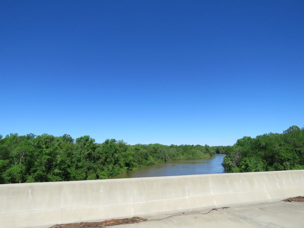
The Congaree River Blue Trail is a 50-mile designated trail for recreational paddling. It was designated a National Recreation Trail by the U.S. Department of Interior in 2008. The trail starts near the city of Columbia and ends at the Highway 601 Landing near the junction of the Congaree and Wateree. It passes through Congaree twenty miles downstream from Columbia.
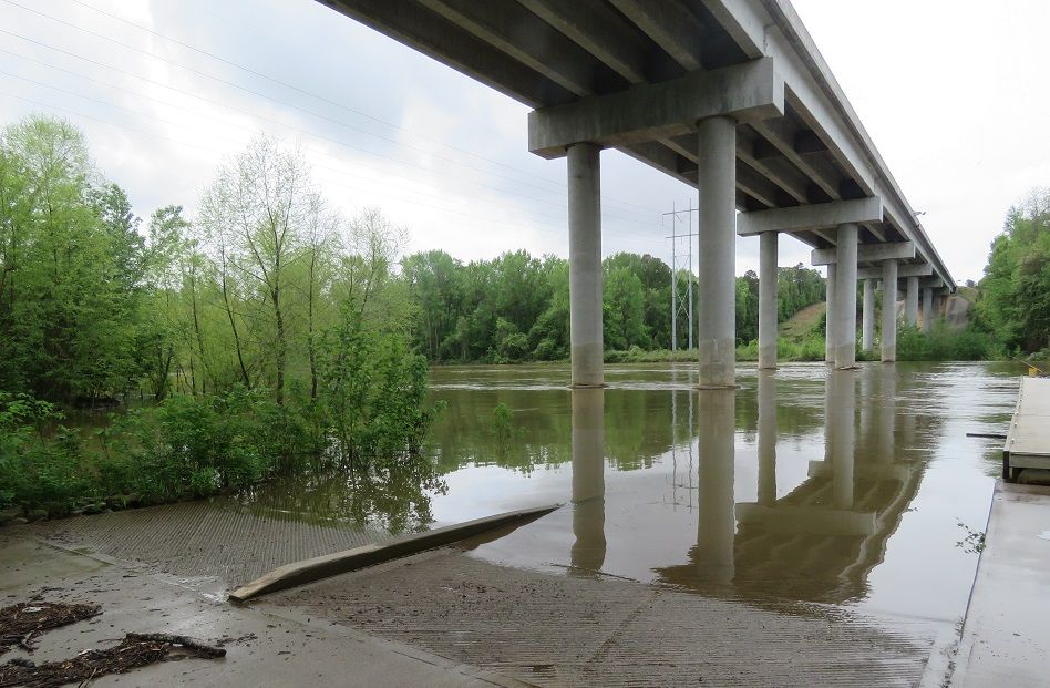
The takeout spot at Bates Bridge Landing has a small floating dock/pier and a large parking area under the Highway 601 bridge. It is on the north side of the river. The next spot to takeout is 10+ miles downriver.
There are a number of canoe and kayak outfitters with available rentals in the Columbia, South Carolina area. When we were planning our adventure, we found one which would move our car from Columbia to the Bates Bridge Landing.
Here are the official water levels of the Congaree River at the gauge in Congaree National Park:
Camping is available on the sandbars of the Congaree River when the river is at appropriate levels. Flood stage of the river is 15 feet on the above chart but sandbars are unlikely to be available when the river is approaching flood stage (definitely in the 12.5-15 foot area).
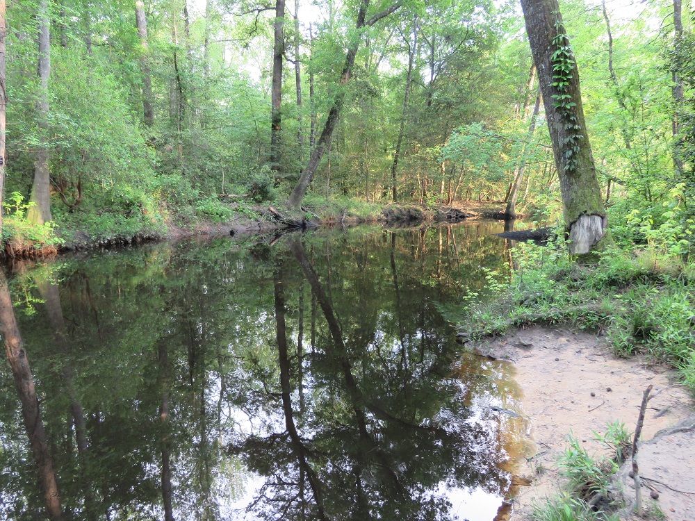
Cedar Creek Canoe Trail
There are two easy access points in the park to the Cedar Creek Canoe Trail. The first is in the northwest corner of the park off of Old Bluff Road at Bannister’s Bridge Canoe Launch. The other option is South Cedar Creek Canoe Launch located east of the visitor center and is accessed from South Cedar Creek Road. The river in both locations is accessed by a short trail where the canoe or kayak would need to be carried.
It is a 15 mile trip through the park starting at Bannister’s Bridge (located on Old Bluff Road) and joining the Congaree River downstream. Cedar Creek Landing is a 6.2 mile trip from the launch and the Route 601 Landing is around 20 miles. If your party is planning to stay overnight in the park, a backcountry permit is needed from the visitor center.
Cedar Creek at Bannister’s Bridge during high water conditions:
Cedar Creek at South Cedar Creek during high water conditions:
Here is the official water levels for Cedar Creek which should be consulted prior to beginning any adventure:
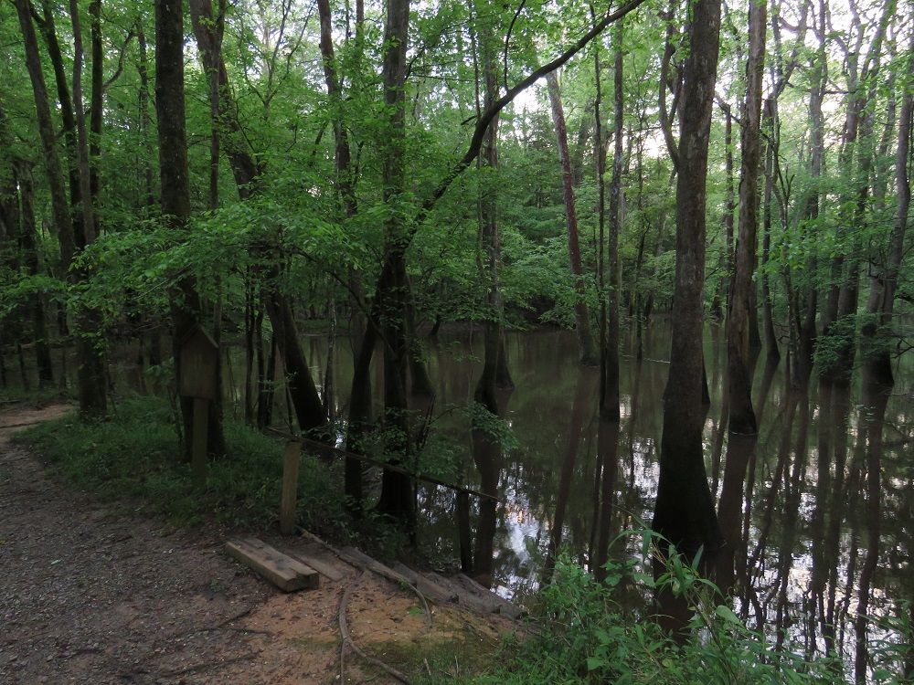
The official flood stage for Cedar Creek is eight feet. During flood stage conditions, the park service does not recommend that individuals undertake a trip. The reason, as we discussed during our own trip to the park with the rangers during flood conditions, is that it is very easy to get lost when the river is over the banks. When the river is between 7-8 feet, the creek is over the banks in certain low lying areas and navigation can also be hard due to both downed trees and insufficient trail markers. We were in the park during such conditions and the rangers discouraged us from attempting any trip.
When the water level is between four and seven feet, this is the ideal conditions. If you are prepared to carry your canoe in certain places, you may also be ok when the water level is between 2.5 and four feet. The recommended route is from the South Cedar Creek Canoe Launch to the Congaree River.
When the water is 2.5 feet or less, the park service discourages paddlers from attempting long trips on Cedar Creek due to the low water conditions where there will be many portages and impasses.
Backcountry Camping
Both the Blue Trail and the Canoe Trail can be done with an overnight stay in the park with a backcountry camping permit. Call the park during normal business hours to obtain a free permit for camping as well as learn the rules for selecting a campsite. The park rangers were very helpful as we planned our adventure to the park. However, advanced planning can be difficult due to changing weather conditions.
If the rivers are near or above flood trails, it may not be possible to do backcountry camping in the park. Permit applications will be denied if it is not safe to stay in the backcountry. When we visited in April 2019, we had to cancel our planned trip down the Blue Trail because there were no sandbars available to safely camp on. The water was averaging a depth of between 13 and 15 feet on the Congaree River gauge at Congaree National Park.
Park Ranger Canoe Tours
Park Rangers offer a limited number of free, guided canoe tours of Cedar Creek each year for visitors. Tours are given on Friday through Sunday in the spring season and Fridays and Saturdays in the fall season. Tours last approximately 3.5-4 hours. Reservations must be made online and open on the first of the prior month. Tours are limited to 12 individuals.
Congaree National Park Hotels
Congaree Camping
Congaree Canoe Trail
Congaree Fireflies
Congaree Weather
Congaree Wildlife
Congaree Boardwalk Loop
Congaree Champion Trees
Bates Ferry
Highway 601 Bridge Landing
South Cedar Creek Canoe Launch
Bannister Bridge Canoe Launch
Why is Congaree a National Park?
Best Time to Visit
Congaree Bluffs Heritage Preserve